

You are hereFly Idaho! Third Edition
Fly Idaho! Third Edition
The Backcountry “Bible”— Even Better
by Crista V. Worthy

It could be argued that Galen L. Hanselman has done more to promote backcountry aviation in Idaho than any other living person. His books, articles, and aeronautical charts are used by thousands of pilots across America and the world. Nearly every pilot in Idaho who flies the backcountry carries a copy of Hanselman’s book, Fly Idaho!, to the point where most simply refer to it as “the backcountry pilot’s bible.” The big news is that, after five years of painstaking labor, the all-new third edition of this indispensable guide is now being printed and is ready for pre-orders.
After the initial 1994 publication of Fly Idaho!, Hanselman turned his attention to other areas with backcountry airstrips. He spent four years researching and writing his follow-up work, Air Baja!. He then published Fly the Big Sky!, a complete guide to Montana’s airstrips. His next project, Fly Utah!, suffered a one-year delay as a result of an aircraft accident. Since the initial publication of Fly Idaho! in 1994, the books have accomplished what their author intended:
1. To provide accurate, easy-to-use data about backcountry airstrips, many of which are not shown on standard aeronautical charts. This helps pilots determine whether they have the necessary skills and equipment to safely operate at a given airstrip.
2. To increase public awareness of irreplaceable backcountry airstrips, and the organizations that are dedicated to preserving them, the Idaho Aviation Association being one of the most prominent. Increased interest in backcountry aviation helped spur the creation of the Recreational Aviation Foundation, too.
3. To bring dollars to nearby FBOs, mountain-flying CFIs, outfitters, guides, hotels, restaurants, and other businesses as pilots explore the backcountry destinations in the books.
By 2010 however, some of the information in Fly Idaho! had become outdated. Trees had grown, lodges had opened or closed, and runways had lengthened or shortened. Hanselman decided it was time for a completely new, updated version of Fly Idaho!, his biggest project by far.
The all-new third edition of Fly Idaho! is a whopping 946 pages, compared with 456 pages in the previous edition. To accommodate all this new info, the book is split into two olumes. The first volume contains the “Air Section” and covers 83 airstrips, compared with 71 in the second edition. Four pages for each airstrip give the pilot quick access to pertinent information needed for safe operations. Most pilots start by looking at the Relative Hazard Index (RHI) in the corner of the first page. Hanselman developed the formula for the RHI system for his original book. He calculates a number between 0 and 50 for each airstrip, with 50 being the most difficult, taking into account such factors as runway length and surface quality, elevation, and surrounding terrain and obstructions. A quick glance at the RHI instantly allows the pilot to gauge the difficulty of operations at a particular airstrip. All-new vertical and horizontal photographs of each airstrip, taken by Hanselman from the air, show each runway and its surroundings, with runway numbers superimposed on the photo, and further help pilots assess the difficulty. A diagram of the airstrip with runway length, elevation, lat/long, and commentary supply additional information.
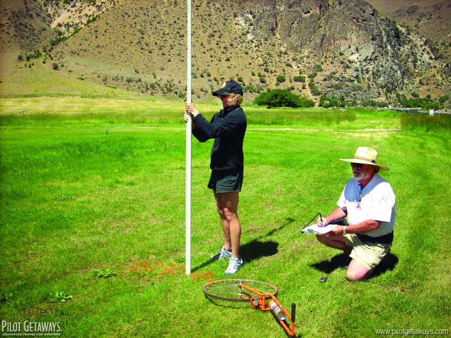 Crista Worthy assists Galen Hanselman in gathering data for one of the airstrips in his book.
The third edition also provides two diagrams first introduced in the Utah book, the Runway Elevation Profile, and Terrain Elevation Model. After Hanselman crashed in Utah attempting an uphill takeoff from a deceptively sloping runway, he developed a system to measure runway slope. For the new Idaho book, he used an improved system, which employs a rotating horizontal laser. The author personally visited every airstrip in the book and painstakingly measured the length and elevation of each runway, as well as the runway slope and elevation changes. To operate safely in the backcountry, it’s crucial to know whether an airstrip is uphill or downhill, and how the slope may change. The Runway Elevation Profile provides that information at a glance. The Terrain Elevation Model shows surrounding terrain, similar to a topo map, which helps the pilot plan a safe descent into a canyon and quickly shows the best way out in case of a go-around.
Educated as a physicist, Hanselman is a stickler for accuracy. I assisted him in taking measurements at several airstrips. At one airstrip, he discovered the battery on his GPS/altimeter device was dead. I had just purchased a new smartphone with GPS, compass, and altimeter functions, so I suggested we use it to determine the elevation and runway directions. He used my phone, but flew back to the strip later to confirm the data with his own equipment.
Other chapters in Volume 1 include Technical Information, a Crosswind Chart, Koch Chart, Backcountry Flying Etiquette, Survival, Mechanical Tips, Wilderness Dos and Don’ts, Airplane Camping, The Zen of Fly Fishing, Author’s Promise to You, and “Dumb Things I Promise Never to Do Again”—the latter is a blank lined page with spaces for pilot/users to fill out when appropriate.
Volume 2 contains the “Ground Section,” full of photos and information about camping, fishing, hunting, hot springs, hiking and other activities. Numerous amusing historical anecdotes are told as only Galen Hanselman can tell them, or, in his words, “stories galore of old timers, miners, trappers, Indians, ne’er do wells, wayward pilots, outlaws, moonshiners, murderers, and sweet little ladies of the night, over 250 illustrations, and more photos than you can shake a stick at.” The new edition also provides Internet links to fishing and hunting info and licenses, guides, rafting trips, and backcountry guest lodges. Buyers of the book will be able to access updates on the Fly Idaho website.
The anticipated delivery date for the third edition is late May 2015. Pre-publication orders will receive the Backcountry Idaho User Waypoint file for free, a $19.95 value. What is this? Fly Idaho! contains 17 airstrips not depicted on FAA sectional aeronautical charts. Hanselman has created user waypoints for these airstrips and put them into a file that can be imported into ForeFlight. As the author says, “Want to fly from Sun Valley to Big Bar? No problemo! The User Waypoint name for Big Bar is—surprise!—BIGBAR. In ForeFlight’s NavLog, enter KSUN and BIGBAR and bingo, your course is laid in to the exclusive BIGBAR waypoint precisely located on the moving map. Want to fly a backcountry route? No problemo! Mix and match as many of the Idaho User Waypoints along with the identifiers of published airstrips and off you go.” On pre-publication orders, credit cards will not be processed until the order is shipped. Orders come with a money-back guarantee. The two-volume book in a slipcase is $59.95; the e-book is $39.95, www.FlyIdaho.com.
Hanselman has been a tireless promoter of backcountry airstrips. His thoroughly researched books have enhanced the reputation of backcountry flying immensely, as an activity to be enjoyed responsibly. His work has stood the test of time and will continue to assist pilots far into the future. With this latest edition of Fly Idaho!, Hanselman has again added immeasurably to the history, lore, and safety of aircraft operations in Idaho’s backcountry. As Harrison Ford says in the book’s foreword, “Don’t leave home without it.”